
Quick info
- An adventurous route in wild nature above the sea.
- Wayfinding challenges on the approach and during the climbing.
- 4 pitches / 185 meters
- 3c / 4a / 3c / 3c
- First three belays bolted, final belay needs to be built. All trad for intermediate protection.
- Descent scramble and hike.
General
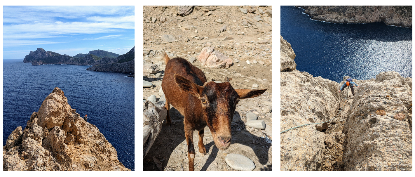
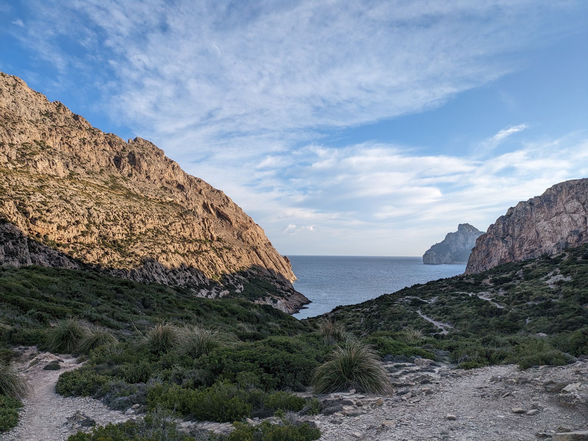
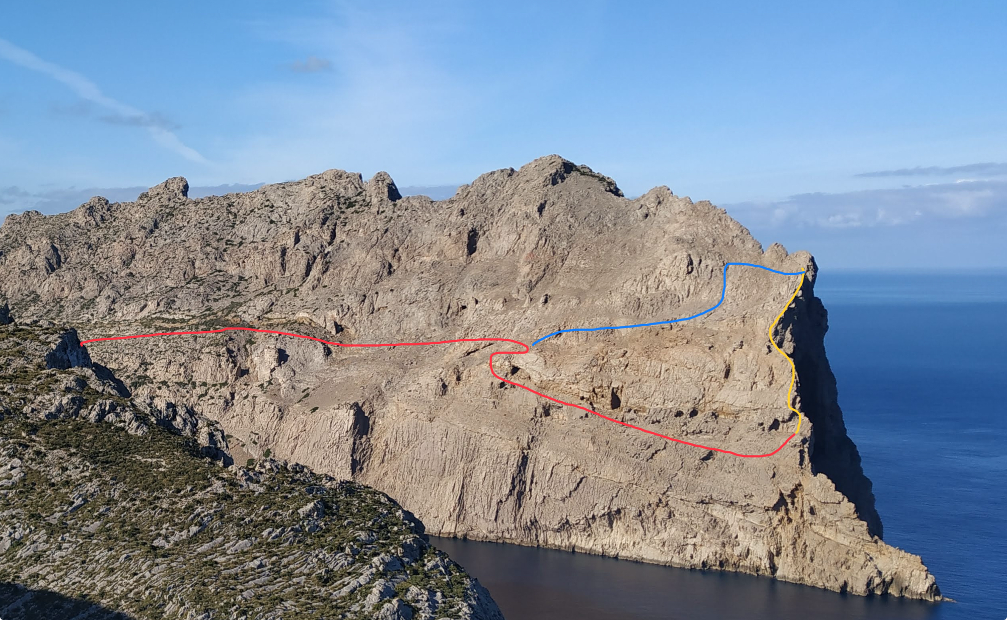
Forming the northern side of the Boquer valley the jagged 300 meter high Cavall Bernat ridge protrudes out to the sea for about a kilometer from the picturesque Cala de Boquer. It ends in a distinct steep cape called the Punta de Troneta (which also hosts a few caves to explore).
For almost any visitor to this area the goal is to have a pleasant hike and a dip into the warm Mediterranean waters at the Boquer beach - but almost nobody continues on beyond this point. From here on out the rocky landscape becomes wild and forms bizarre formations and caves.
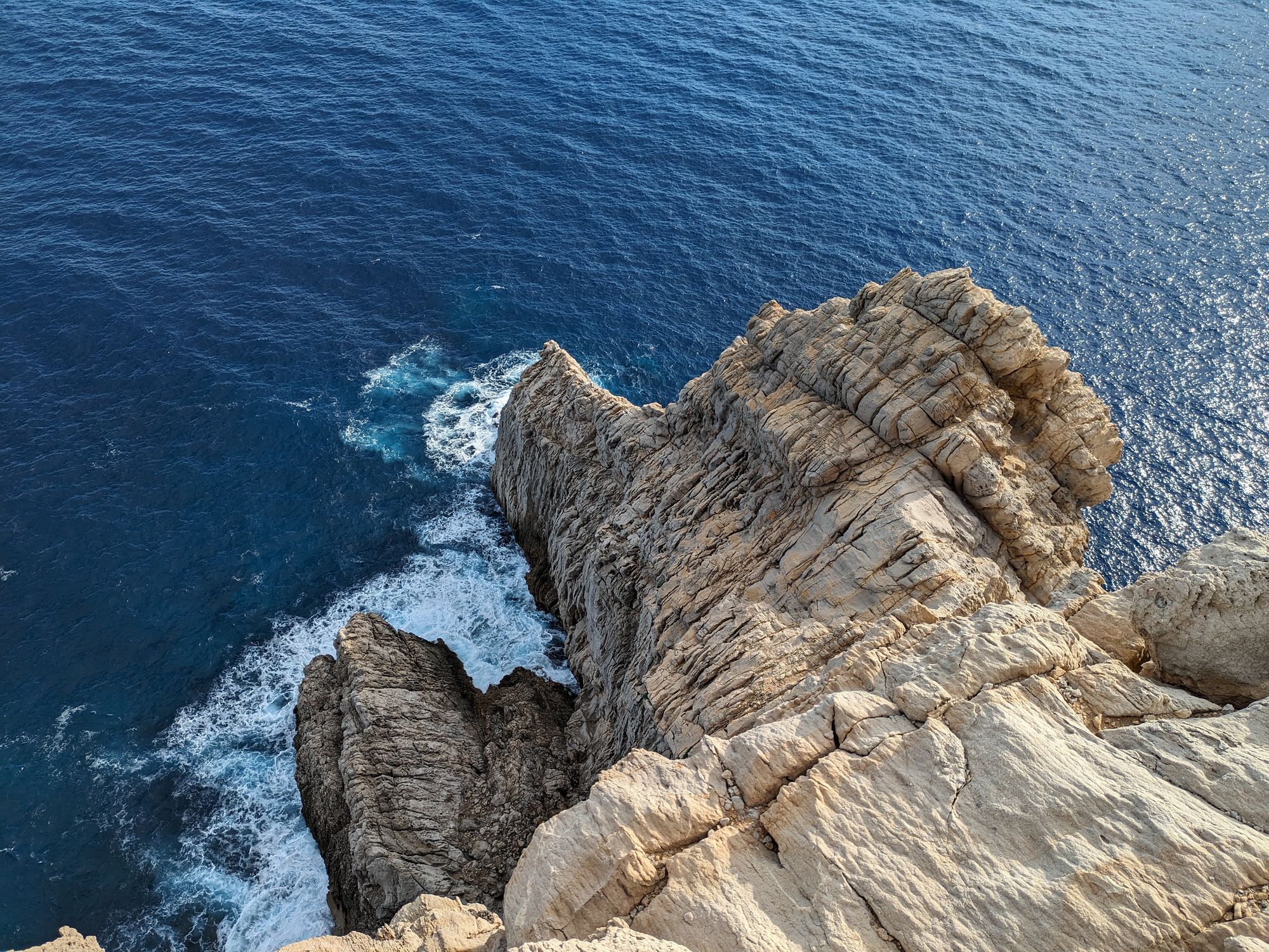
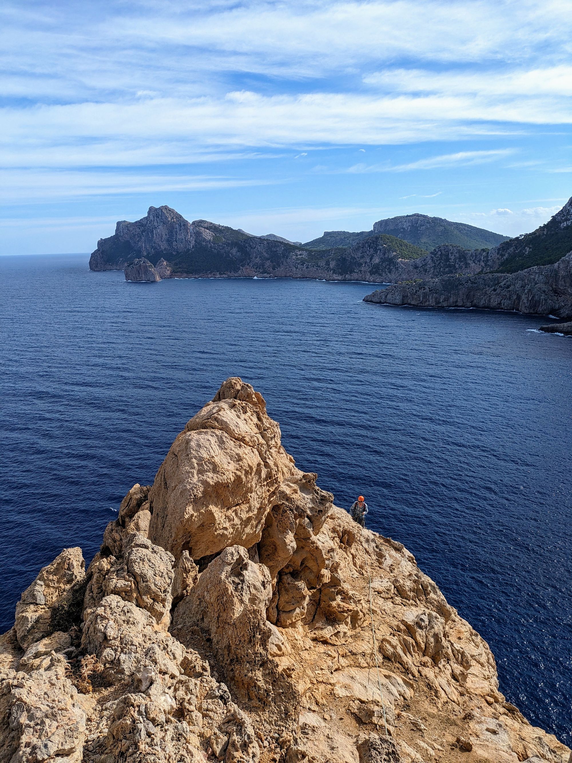
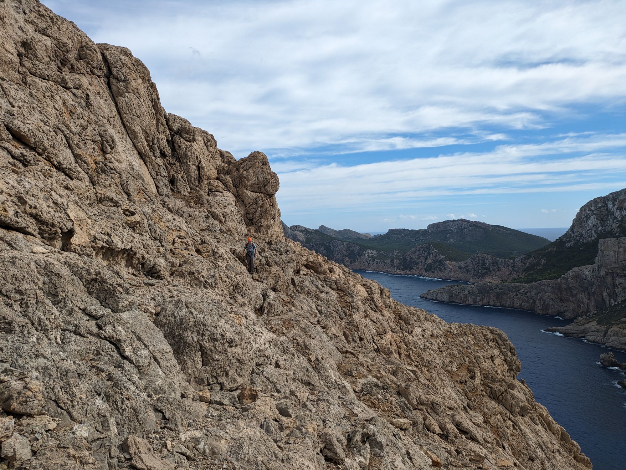
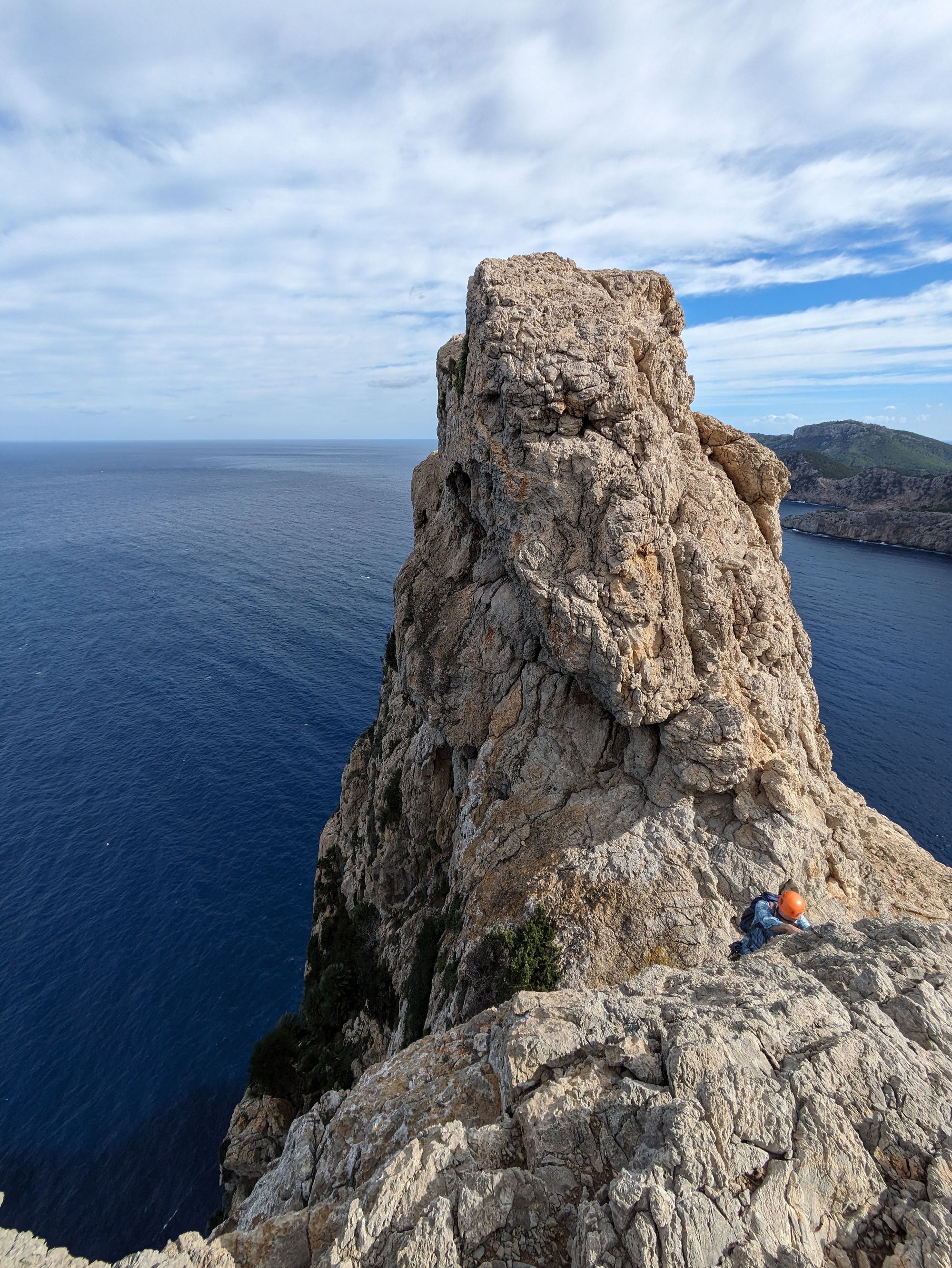
The East Arete that this route climbs is the outermost edge of the Cavall Bernat and surrounded by the sea on both sides. It very closely hugs the edge and offers stunning views out to the sea and along the coastline towards the Cap de Formentor.
Fairly easy climbing and the lack of intermediate protection means that every climbing party has to search their own way up. Add the questionable rock quality and the long approach / descent and you got every ingredient for a real alpine adventure.
Read a report on one ascent of the route here.
Logistics
Same as for Agulla de Boquer: To reach this climb either park the car right at the ring road of Port de Pollenca (leading further on the Formentor peninsula) close to the start of the approach hike (marked on the map) or somewhere in town.
Parking downtown might be a good idea if you plan to visit the promenade and harbor area later for a coffee or maybe a nice lunch in the sun. The waterfront area is quite touristy but still worth a stroll.
Approach and descent
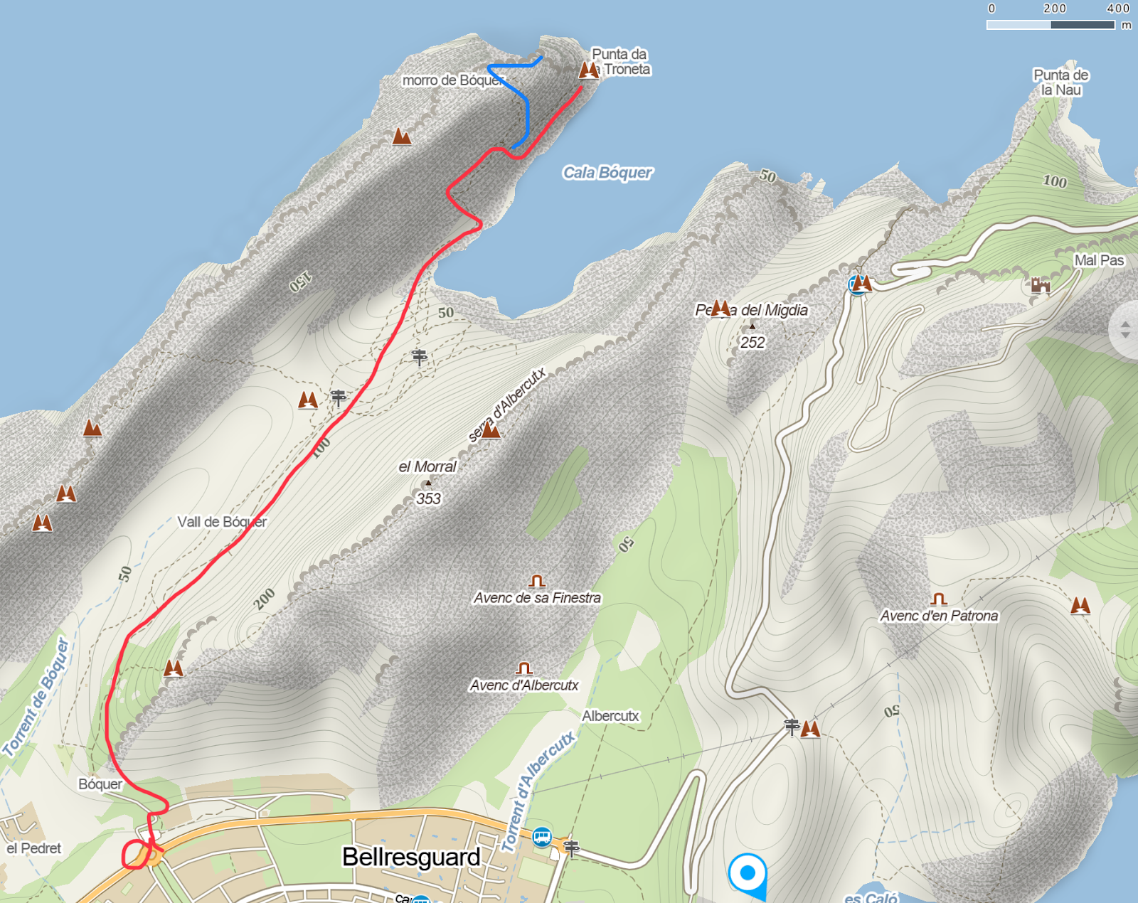
To reach the base of the climb, hike through the Boquer valley down to the Cala de Boquer. From here scramble up the scree on the left hand side and then follow cairns to the right for a few hundred meters. Keep an eye out to the left and as soon as a weak spot appears in the walls the cairns will lead towards it.
Turn left and steeply follow the cairns until the path turns right again. Soon after the path splits into the normal route up the Morro de Cavall (left) and the path to the caves at the end of the Serra and the start of the route (right).
At the split the path will turn back on itself and down to a series of terrasses. Again follow the cairns on the ledge until you reach the iron spikes leading down to the caves.
Between the first and second spike climb up easily to the left for 10 meters to a ledge. Tie in here. About 1h-1h30 in total.
Descent: Travers right and slightly up (following spaced cairns) until just under the highest point of the Morro de Cavall. Here the normal route comes up from below and left. Either follow the normal route down until you reach the approach path (about 1h back to the car park) or continue into the Cavall Bernat Traverse (also described in the Mallorca Adventure Guide) - note that continuing will make this a very long day out (additional 4-5 hours)!
Technical information
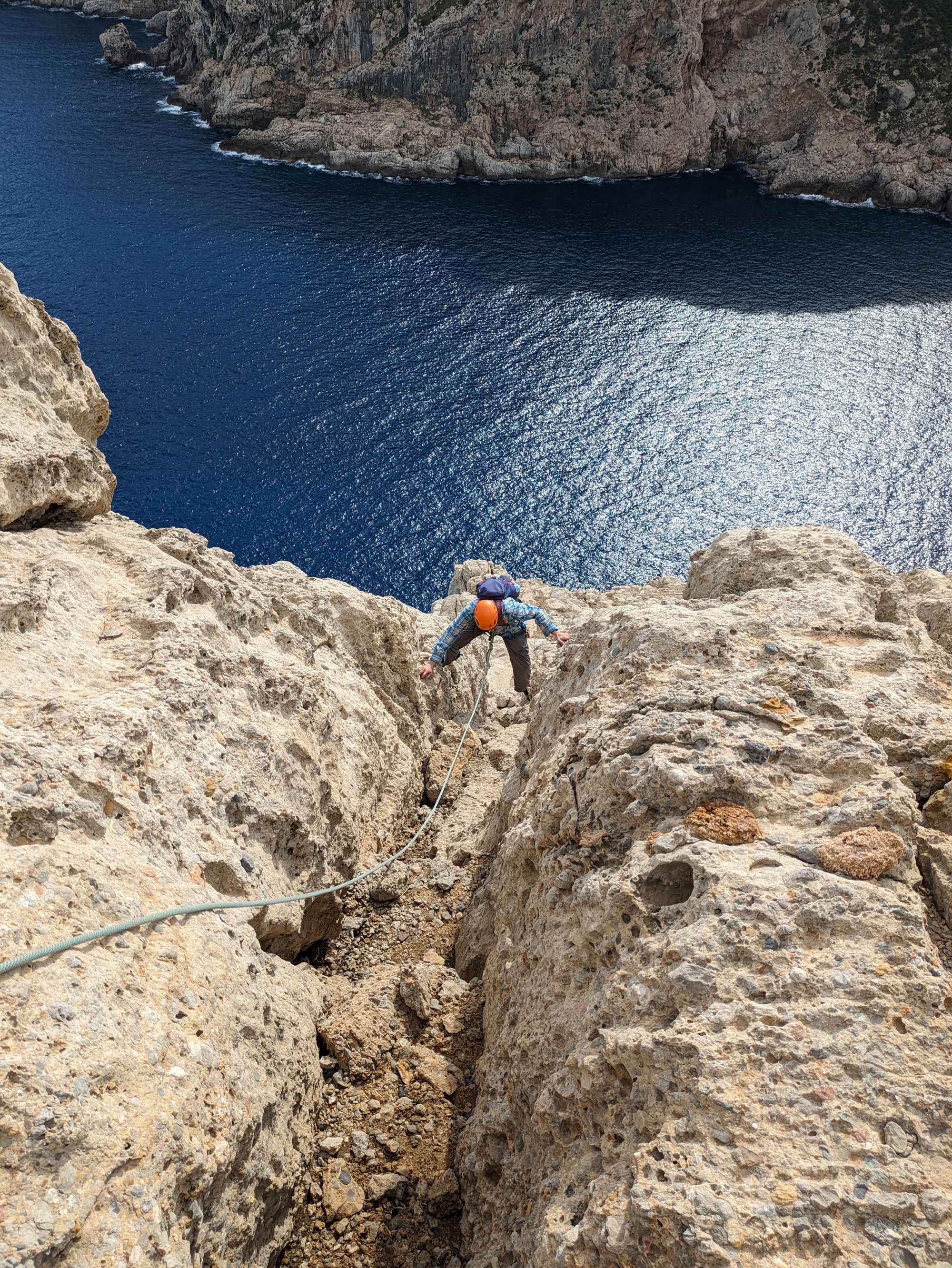
- Four long pitches right on the arete with a steep drop into the sea to the right.
- Belays 1 to 3 are bolted with two expansion bolts each. The fourth belay needs to be built (good sling and cam placements). No fixed gear during the pitches, but very well protectable.
- Poor rock quality in places and loose rocks on ledges and low angle ground. Even if the climbing is easy a breaking hold or slip could lead to a fall.
- Gear: 60 meter single rope, 5-10 quickdraws, slings, cams / nuts (Camelot 0,75 to 2 work very well).
- Long pitches lead to rope drag.
- East facing and exposed to wind. Due to the position right above the sea winds can become really strong even if it is calm on the rest of the island.
Climbing and pitches
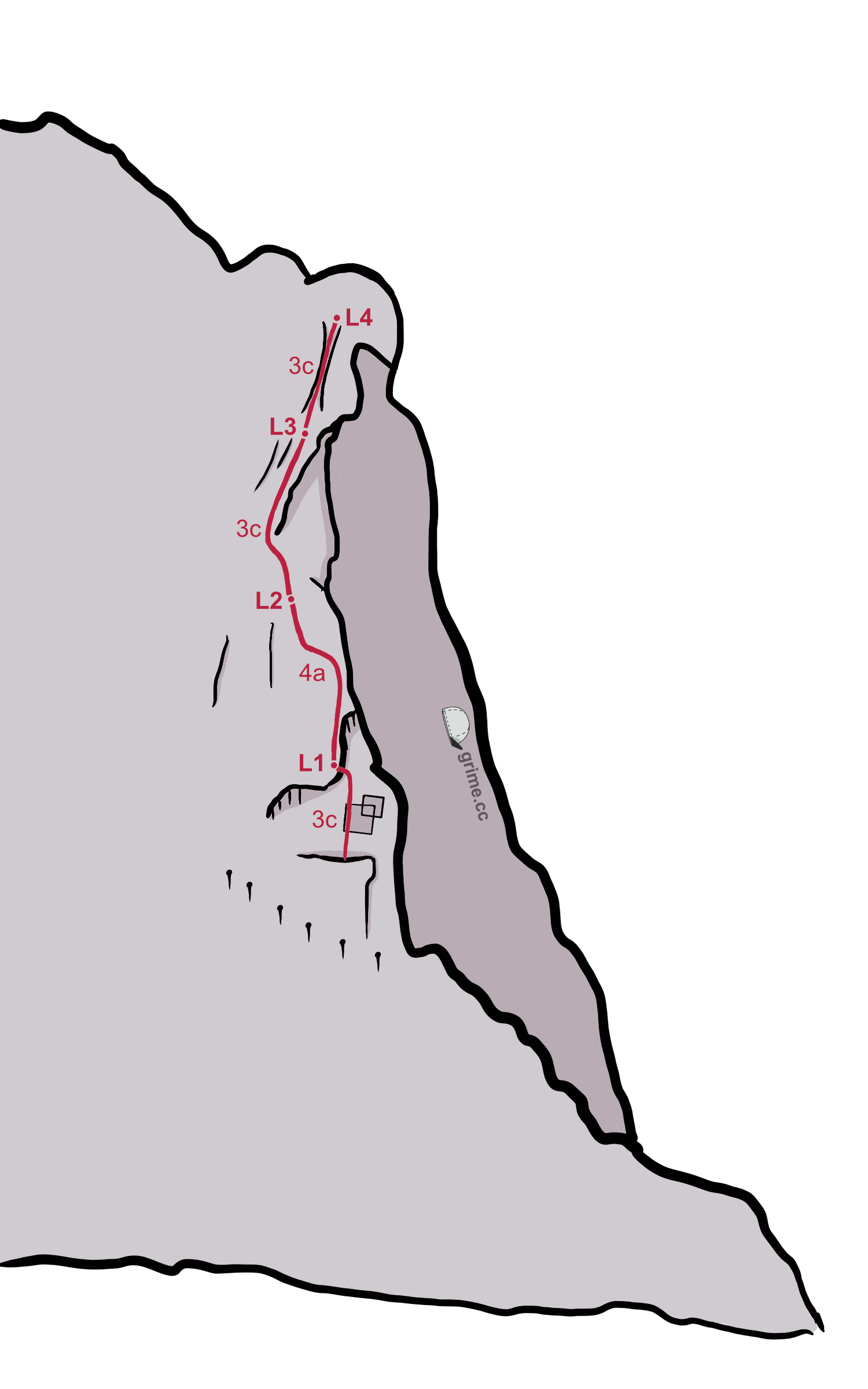
In general the climb keeps close to the right edge of the arete - make sure to check over the edge from time to time that you are still on route. The belays can be hard to spot. Take care when committing to holds as the rock is very brittle. The whole climb takes about 1.5 to 2 hours.
The description below is only a rough guide. Be prepared to search your own way up.