Quick info
- A three kilometer long sharp ridge that falls off 300 meters into the sea
- Sustained scrambling over several hours call for endurance and concentration
- No technical gear needed
General
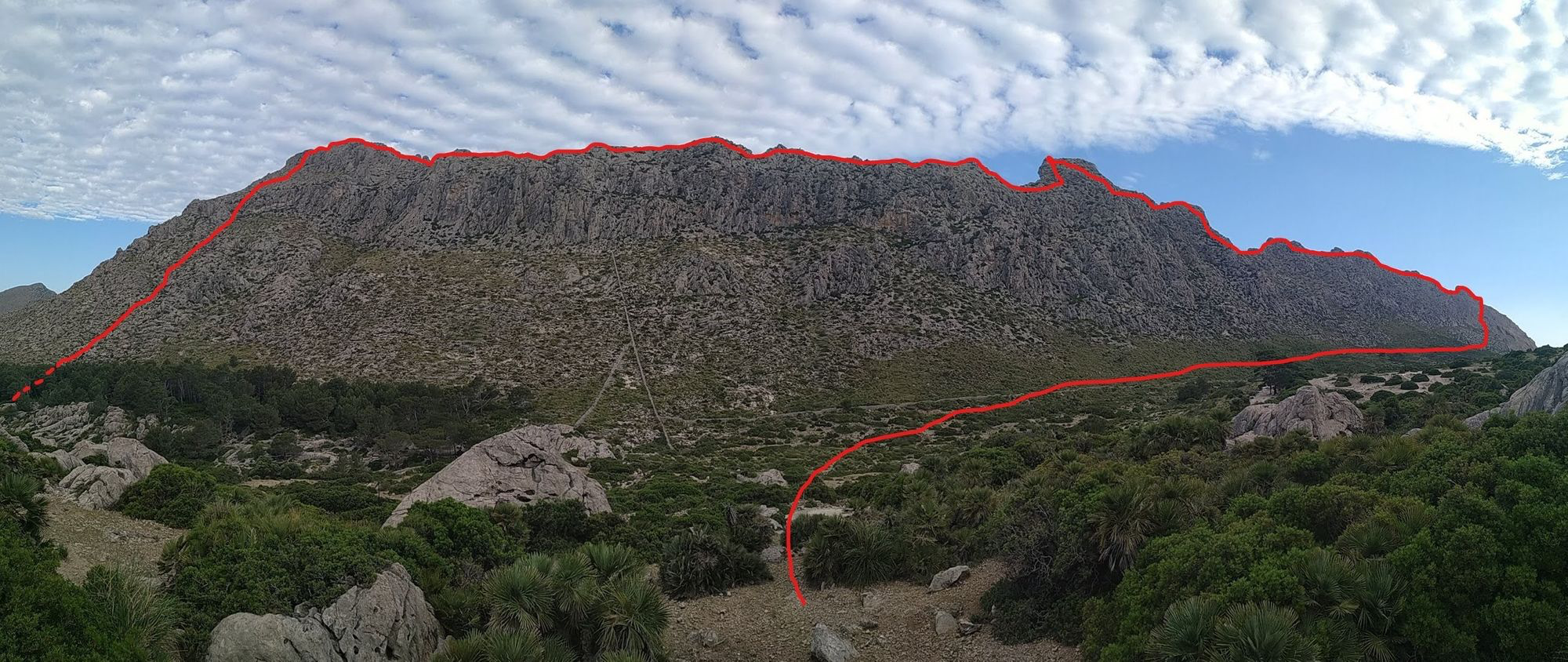
The Boquer valley, which is home to the Agulla de Boquer climb described in this guide, is formed by the Serra d´Albercutx on the one side and the Serra de Cavall Bernat on the other. Of the two the Cavall is definitely the more striking with several towers and gaps forming a jagged line against the sky.
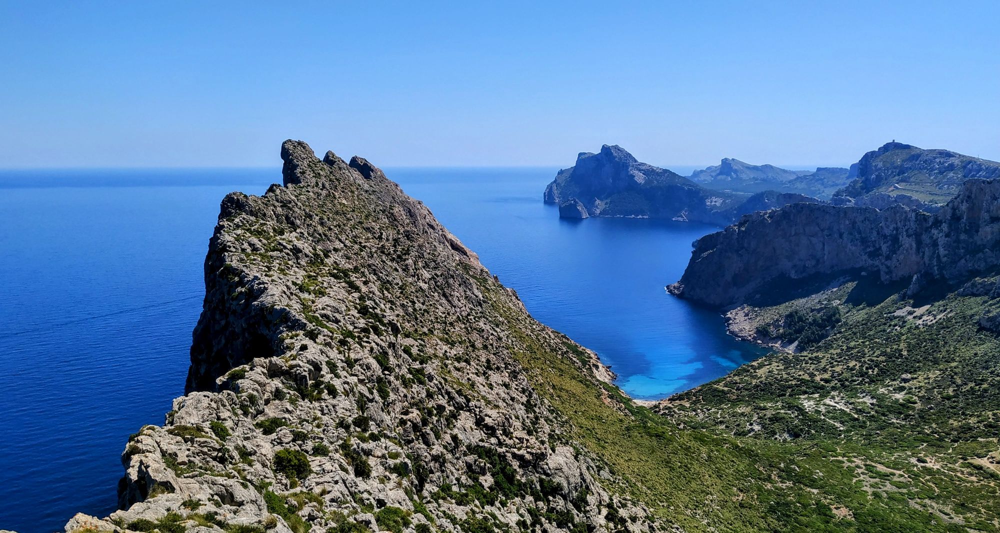
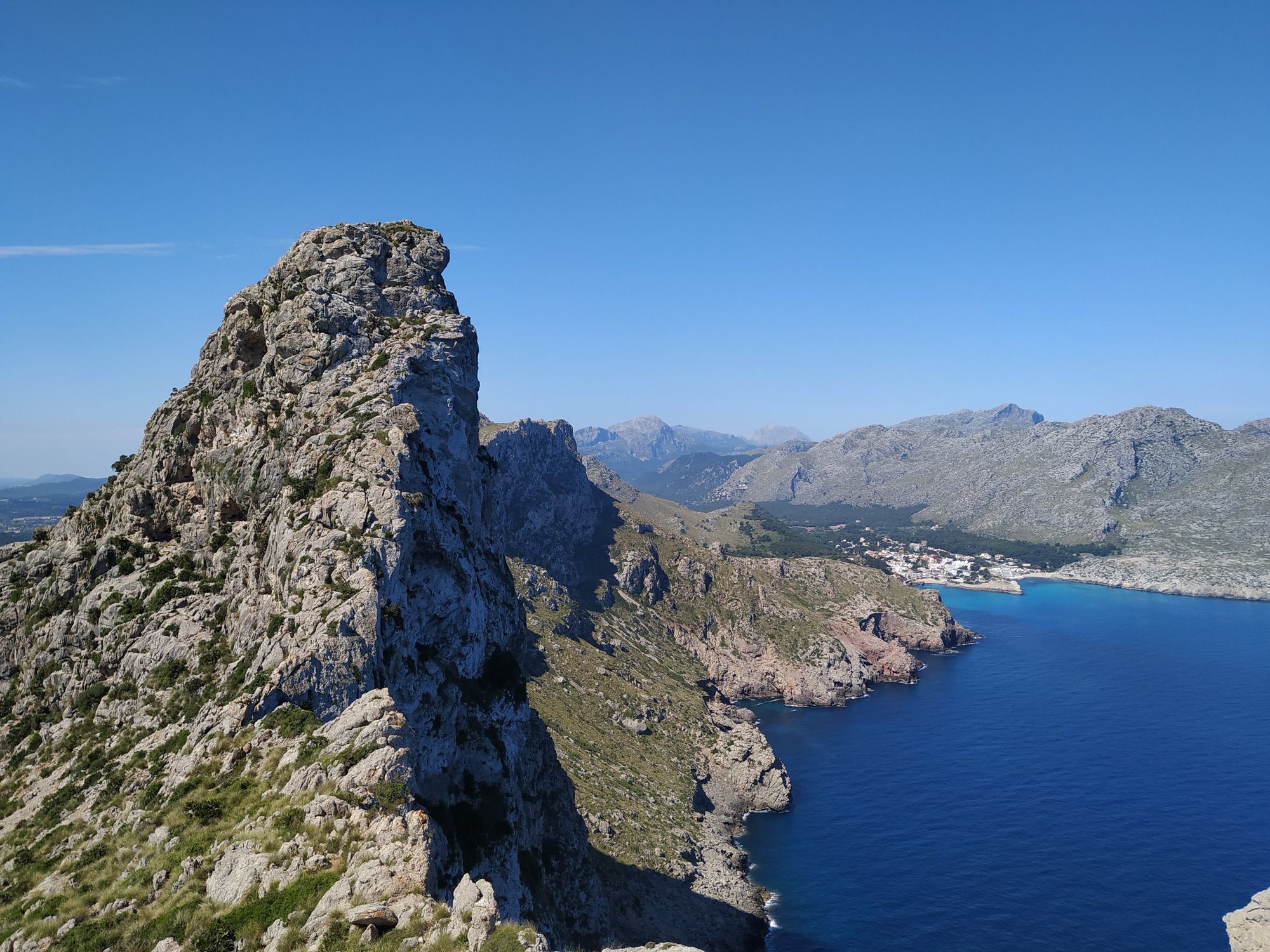
The ridge is 300 meters high at most and falls steeply into the sea on the one side and only a little less steeply towards the Boquer valley. From the top the view into the Tramuntana mountains, out to the cap of Formentor and down into the blue sea make for a beautiful setting all the way.
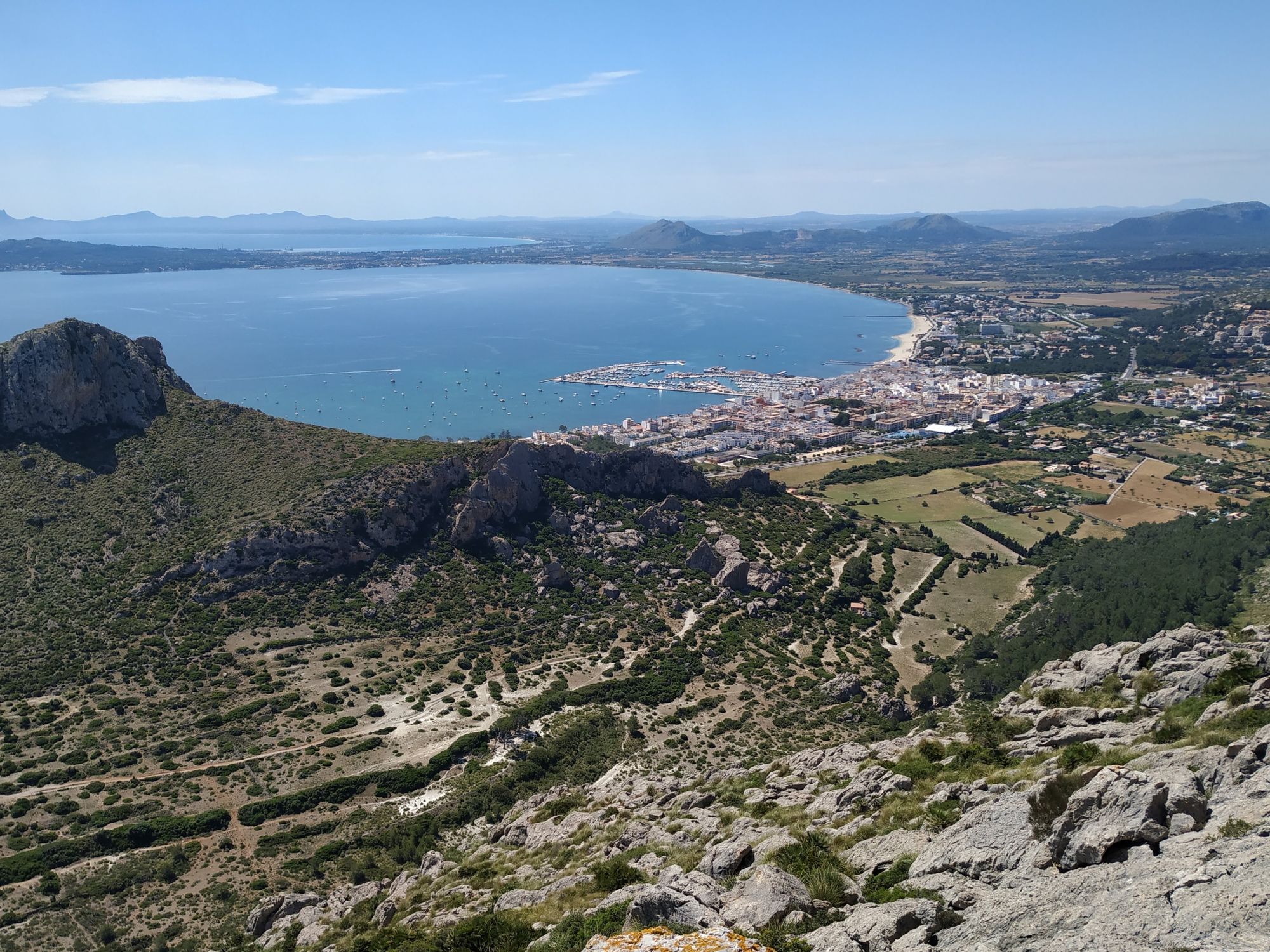
Besides its natural beauty the Cavall Bernat does have a small place in mountaineering history as well. Walter Bonatti, one of the climbing greats and pioneers, has been living in the small village of San Vicente right at the foot of the ridge for some time.
Traversing it is not a highly technical endeavor but the length of 3km, the sustained scrambling terrain and countless short climbing sections make it a test of endurance and concentration.
A report on this tour can be found here.
Logistics
Use the same parking spot by the road as described in the chapter on the Agulla de Boquer. This will be a long tour and to do it in the same day as the Agulla would only be possible for a very quick party. Combining it with the East Arete of Cavall Bernat would also be possible but again lead to a very long day.
Approach
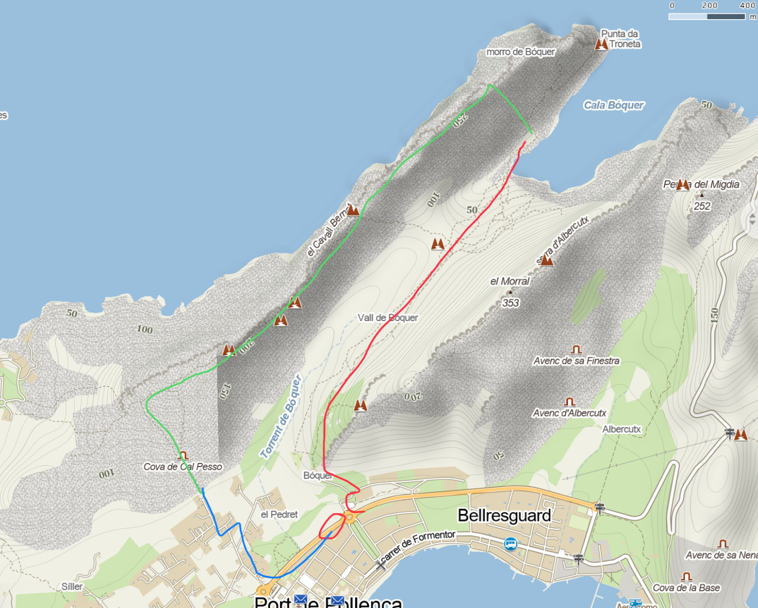
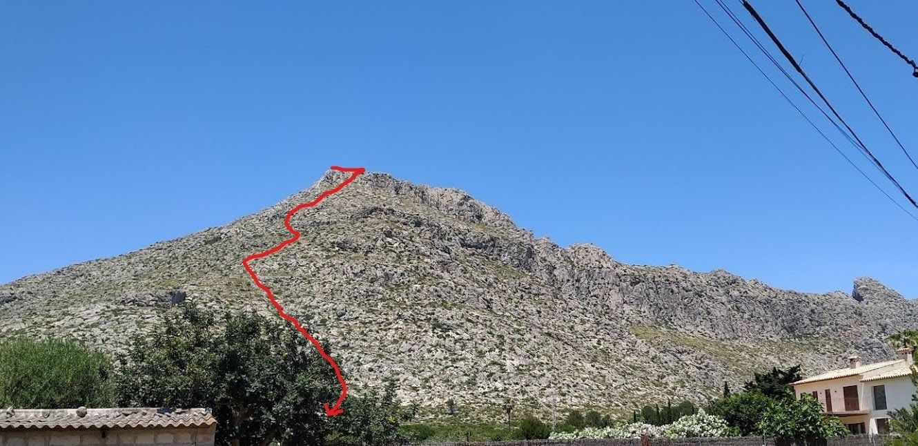
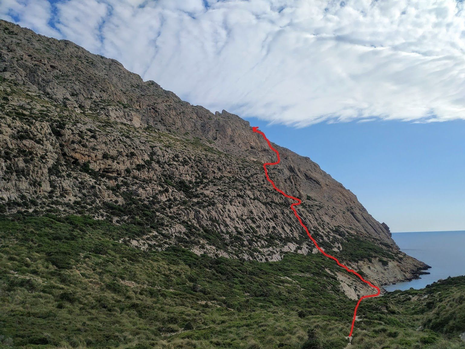
From the parking walk up to the finca building at the entrance of the Boquer valley and through the gates. Follow the very obvious hiking path towards the Cala de Boquer. At the point the trail descends towards the Cala keep left and look for a weakness in the ridge to ascend.
The descent form the final peak of the ridge (Sa Talaia Vella) ends in a small settlement. Follow the road down towards the main road around Port de Pollenca. Finally follow that road towards Cap de Formentor and back to the parking spot.
Technical information
- This tour can be very long depending on your parties ability to move quickly through alpine terrain. Plan for six hours at least.
- Almost all of the movement on the ridge is on sharp, weathered limestone rock which is made to twist ankles and cut up hands.
- There is no need for climbing equipment. However a set of gloves might be a good idea to save the skin. Trekking poles are less useful as you will need to use your hands a lot of the time.
Route finding
At the end of the approach look for a line up the side of the ridge right at the edge of the rocky beach. There are many options for the ascent up and you can choose your own adventure. Most likely you will reach the top of the ridge a few hundred meters from the very North-East end.
Once on top start moving towards the South-West trying to stay as high as possible. Again there are many options how to get around or over the many smaller and bigger obstacles along the way.
Right at the half-way point and before one of the major towers there is an option to scramble down into the Boquer valley. This is a good place to check if you are still on schedule.
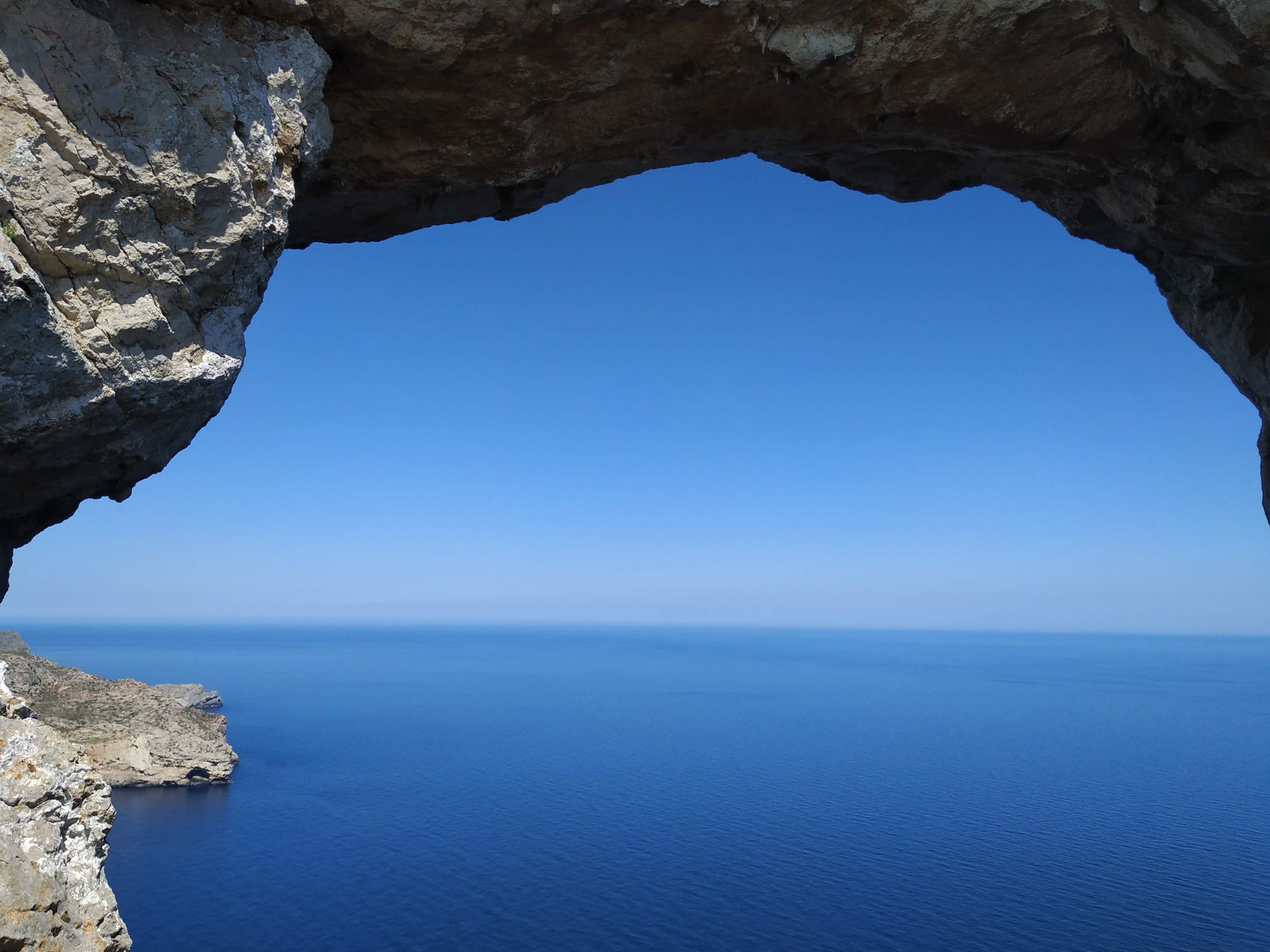
From the escape point climb the impressive looking but easy tower. A short time later you will pass the large rock window that you will have spotted during the approach hike already.
After this quite technical bit the going gets easier and you most likely will pick up some speed. Continue on until the top of Sa Talaia Vella. There is a faint path marked by carins leading down towards the houses to follow. The way down will drag on quite a bit and stays tricky especially after the long traverse.